[View 9x enlarged version (186K)]
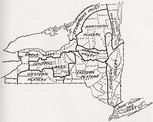
Map showing the ten climatic divisions of the State of New York: Long Island Coast, Hudson Valley, Mohawk Valley, Northern Plateau (Adirondack Mountains), Eastern Plateau (including Catskills), Great Lakes, St. Lawrence Valley, Champlain Valley, Central Lakes (including Finger Lakes), Western Plateau. Of the six Mohawk Valley counties, Montgomery, Fulton, Herkimer and Oneida are located in the Mohawk Valley division, while Schenectady lies in the Hudson Valley division and Schoharie in the Eastern Plateau division. Map from the Agricultural Manual of New York State.