[View 9x enlarged version (90K)]
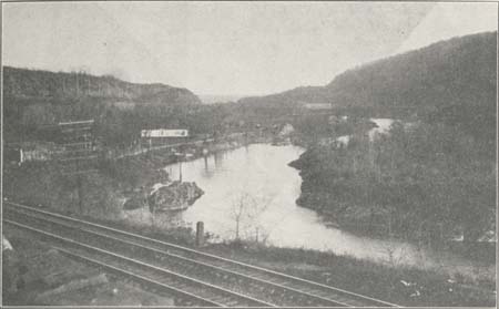
Photo: Little Falls Gorge East of Railroad Curve.
Showing north side Fall Hill on the left (rising to 1060 feet sea elevation and 738 feet river elevation) and south side Fall Hill on right (rising 920 feet sea and 598 feet river elevation). View shows New York Central R. R., Dolgeville R. R., and Mohawk Turnpike on left of Mohawk. (New York State Barge Canal channel in distance), with the line of West Shore R. R. on the right. The south shore highway is a rough mountain road along the south cliff, over 200 feet above river. The Mohawk flows from the deep spot on the right, through a deep rocky channel but little more than 100 feet wide. Moss Island, on the right, and the north shore bank have many wonderful potholes. Central, on the left, 215th milestone from New York on right of tracks.