[View 4x enlarged version (256K)]
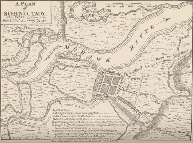
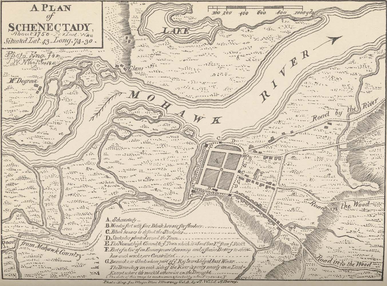
Copied from map in a curious little volume in the New York State Library, containing plans of royal forts in North America. This was doubtless engraved from a sketch by an officer of the British army stationed here or in the vicinity, and probably dates from the close of the "Old French War," or the beginning of the "2d French War," say from 1748 to 1763. (Photo-engraving.)
Map text: A Plan of Schenectady about 1750 — Fr. & Ind. War. Situated Lat. 43. Long. 74.30. Photo Eng for J. W. MacMurray.
Labels include Lake and Mohawk River, "Mr. Degrave" at top left and Road from Mohawk Country at bottom left. The right side has Road by the River, Road in the Wood and Road into the Wood.
Key to markings within the boundaries of the Town of Schenectady:
- Schenectady
- Wooden fort with four Block houses for flankers
- Block houses to defend the Stockades
- Stockades planted round the Town
- The Nearest high Ground to ye Town which is about 800 Yds. from ye Stocks
- Part of a line of an Encampment thrown up and a facing Battery to shew how such works are Constructed
- Barracks or Sheds where part of ye Regt. were Lodged Last Winter
The Boundary of each side of the River is pretty nearly on a Level — Except where it's mark'd otherwise on the Draught.
[The date of this map is unknown; probably about 1750-1760.]
Photo Eng. for Major MacMurray U.S.A. by A. Wild, Albany.