[View 4x enlarged version (674K)]
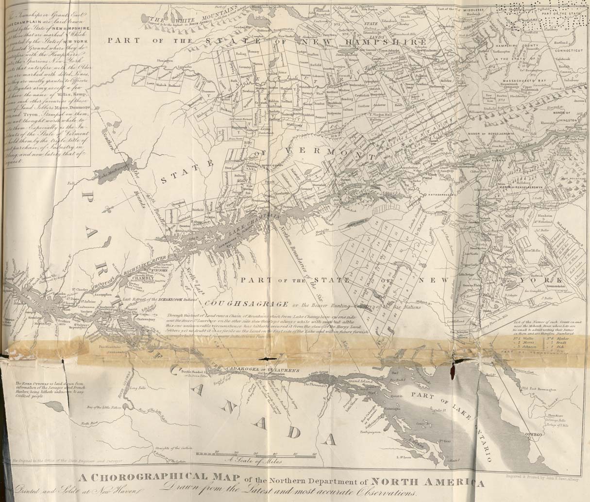
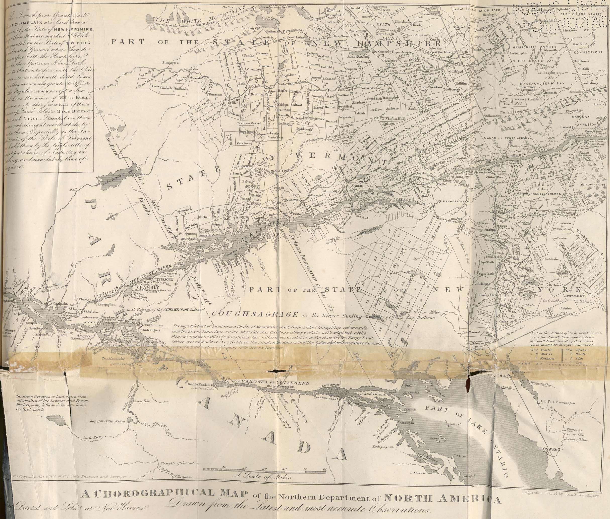
[From the book:] This map is added as showing routes to Canada and the names of places cited in the text. The representation of all western New York to near the present Utica, as part of Pennsylvania is curious. There are other features of interest in it. (Steel engraving.)
Top edge: "The White Mountains, supposed to be the highest in North America, Visible from a Great distance at Sea" followed by parts of New Hampshire, Massachusetts and Connecticut.
The upper left side of the map contains this note:
"The Townships or Grants East of Lake Champlain are laid drawn as granted by the State of New Hampshire, except those that are marked Y Which were granted by the State of New York on unlocated Ground, where they do not interfere with the Hampshire Grants, the Spurious New York grants that interfere with the Older ones are marked with dotted Lines, and as they are mostly granted to Officers except a few which have the name of Wallis, Kemp, and some such other favourites of these Princes of Land Jobbers Moore, Dunmore, Colden and Tryon, Stamped on them, it was not thought worth while to note them: Especially as the Inhabitants of the State of Vermont now hold them by the triple title of honest purchase, of Industry in Settling, and now lately that of Conquest."
followed [left to right] by Canada beginning at Lake St. Peter, then Vermont and New York south to "Manor of Renselaerswyk" and the Blue Mountains.
South (to the right of) Cagnawaga and Chateauguay is the heading, "Coughsagrage or the Beaver Hunting Country of the Six Nations"
followed by
"Through this tract of Land runs a Chain of Mountains which from Lake Champlain on one side and the River St. Laurence on the other side shew their tops always white with snow but altho this one unfavourable circumstance has hitherto secured it from the claws of the Harpy Land Jobbers yet no doubt it is as fertile as the Land on the East side of the Lake and will in future furnish a comfortable retreat for many Industrious Families"
Lower left:
"The River Ottowas is laid down from information of the Savages and French Hunters; being hitherto unknown to any Civilized people"
Lower right:
List of the Names of such Grants on and near the Mohawk River whose Lots are too small to admit writing their Names on them and are therefore Numbered
- Wallis
- Morris
- Johnson
- Herkeman
- Livingston
- Bleeker
- Bradt
- Dick
- Lyn
- Morris