This page conforms to the XHTML standard and uses style sheets. If your browser doesn't support these, you may not see the page as designed, but all the text is still accessible to you.

SCHENECTADY DIGITAL HISTORY ARCHIVE

Bringing the heritage of Schenectady County, New York to the world since 1996

You are here: Home » Resources » Pearson's History » Map of Schenectady in 1695

Map of Schenectady in 1695 — Rev. John Miller

Go back to: Fortifications and Garrisons

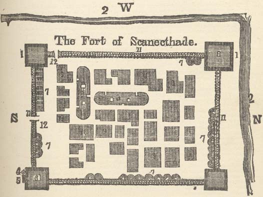
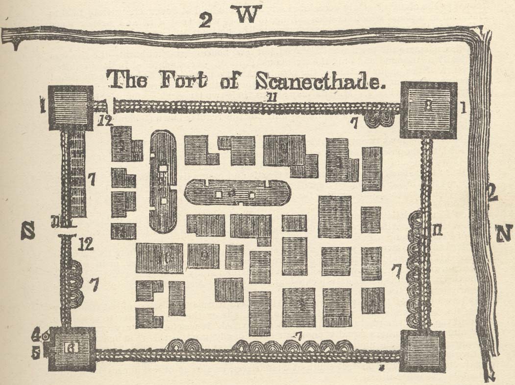
[This information is from p. 311 of A History of the Schenectady Patent in the Dutch and English Times; being contributions toward a history of the lower Mohawk Valley by Jonathan Pearson, A. M. and others, edited by J. W. MacMurray, A. M., U. S. A. (Albany, NY: J. Munsell's Sons, Printers, 1883). It is in the Schenectady Collection of the Schenectady County Public Library at Schdy R 974.744 P36, and copies are also available for borrowing.]

[Copies of this book are available from the Schenectady County Historical Society.]

The Fort of Schanecthade: Map of Schenectady in 1695 — Rev. John Miller.

[Original in British Museum — View 4x enlarged version (148K)]

Explanation:

  1. Block houses
  2. Rivers running beside ye Fort
  3. Indians Wigwams
  4. Flag staff
  5. Centry box
  6. Spy loft
  7. Sties for hogs
  8. The block house designed for a church
  9. Those and others like them houses
  10. A great barn
  11. The treble stockadoes
  12. The Fort Gates

Go to top of page | back to: Fortifications and Garrisons

You are here: Home » Resources » Pearson's History » Map of Schenectady in 1695

http://www.schenectadyhistory.org/resources/patent/miller_map.html updated March 30, 2015

Copyright 2015 Schenectady Digital History Archive — a service of the Schenectady County Public Library

Statcounter