This page conforms to the XHTML standard and uses style sheets. If your browser doesn't support these, you may not see the page as designed, but all the text is still accessible to you.
[View 4x enlarged version (210K)]
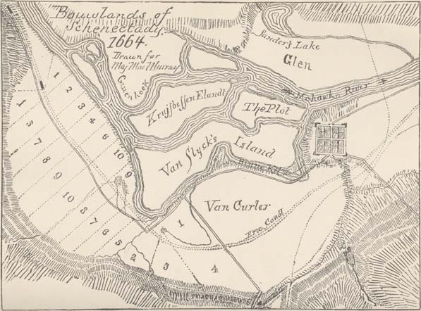
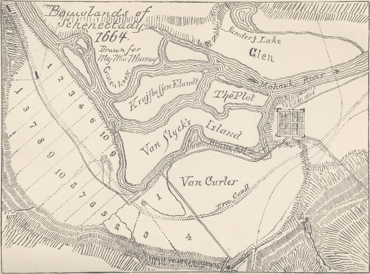
Map text: Bouwlands of Schenectady 1664, drawn for Maj. MacMurray. Map constructed from actual survey and the ancient deed.
(Includes locations of numbered farms)
Place names (left to right, top to bottom) include:
- Graven hoek
- Sander's Lake
- Glen
- Krujsbessen Elandt
- The Plot
- The Mohawk River
- Van Slyck's Island
- Van Curler
- Schermerhorn's Mills
https://www.schenectadyhistory.org/resources/patent/bouwlands_map.html updated December 19, 2024
Copyright 2024 Schenectady Digital History Archive — a service of the Schenectady County Public Library