This page conforms to the XHTML standard and uses style sheets. If your browser doesn't support these, you may not see the page as designed, but all the text is still accessible to you.
SCHENECTADY DIGITAL HISTORY ARCHIVE
Bringing the heritage of Schenectady County, New York to the world since 1996
You are here: Home » Resources » Pearson's History » Illustrations
Go back to: Table of Values | ahead to: Preface
[This information is from pp. v-vii of A History of the Schenectady Patent in the Dutch and English Times; being contributions toward a history of the lower Mohawk Valley by Jonathan Pearson, A. M. and others, edited by J. W. MacMurray, A. M., U. S. A. (Albany, NY: J. Munsell's Sons, Printers, 1883). It is in the Schenectady Collection of the Schenectady County Public Library at Schdy R 974.744 P36, and copies are also available for borrowing.]
[Copies of this book are available from the Schenectady County Historical Society.]
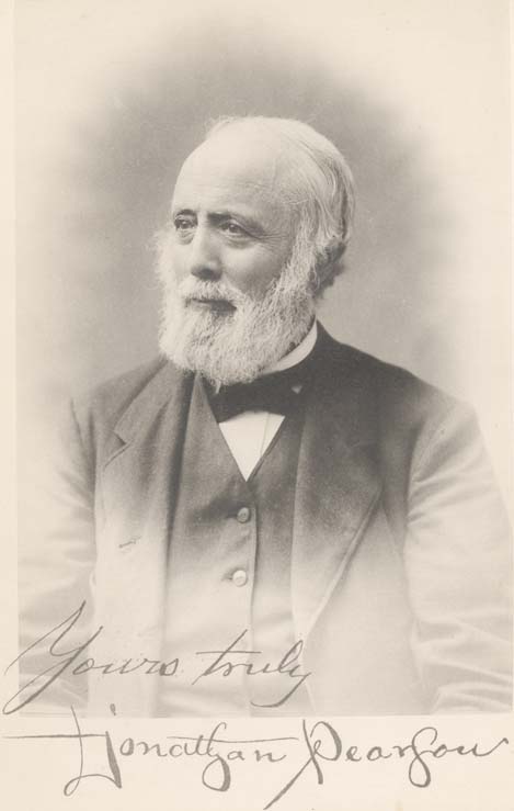
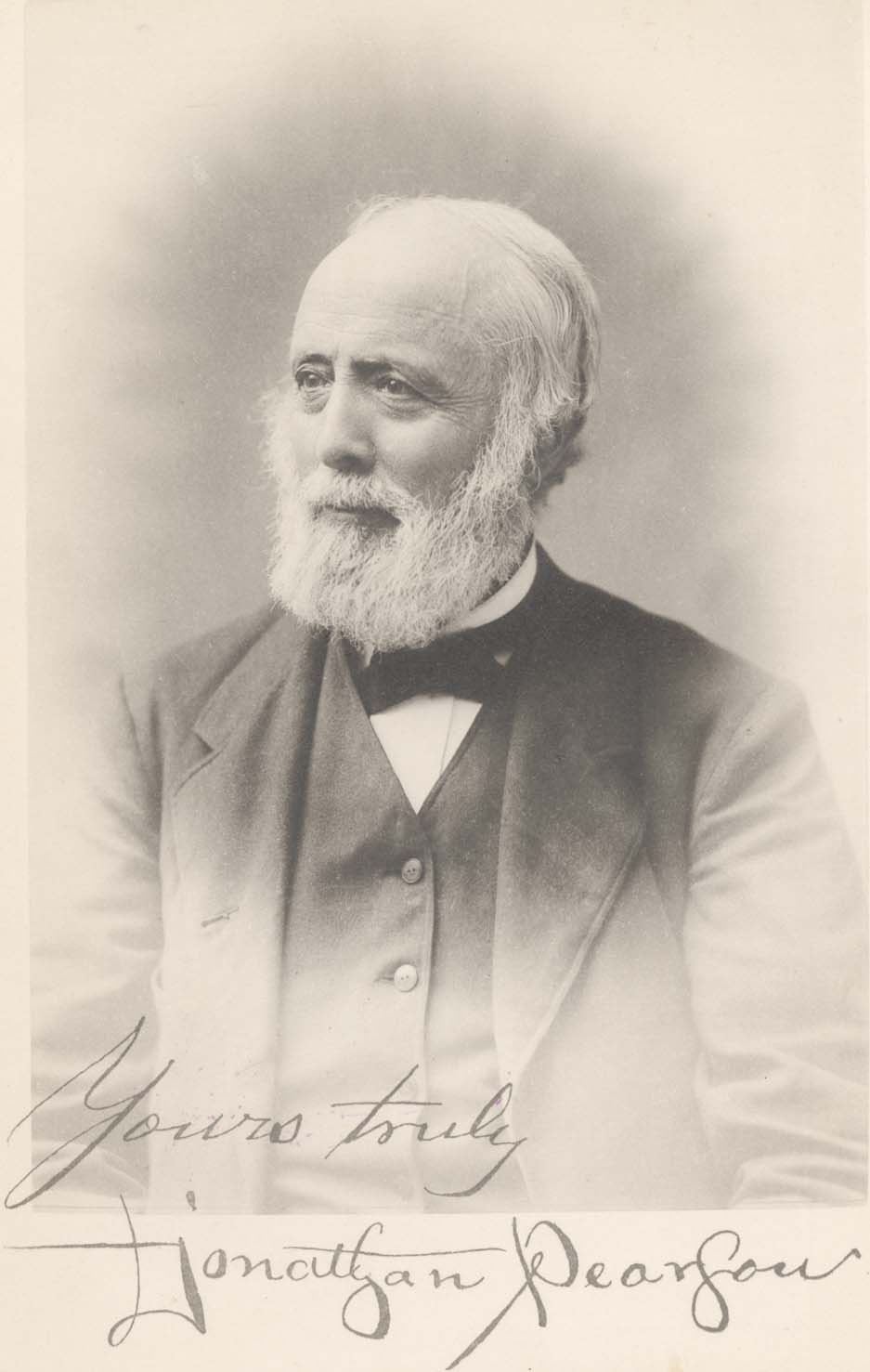
With signature. (Heliotype.)
(Cuts.)
Constructed from actual survey and old deeds and descriptions. The four town blocks are also shown.
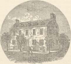
This old house is brick on front and sides, wood in rear. Bricks are set in colored pattern. (Heliotype.)
And facsimile signature. (Cut.)
(Heliotype.)
(3d Flat, cut.)
(Cut.)
Engraved from a painting partly by Giles F. Yates. (Cut.)
(Photo-engraving.)
From Sauthier's map published in London in 1779, from data in colonial offices. The map was prepared for military purposes and shows minute details as to hofstedes, indicating with remarkable detail, buildings and enclosures. It may be considered as accurate enough for the period from 1730 to 1780. (Photo-engraving.)
This map is added as showing routes to Canada and the names of places cited in the text. The representation of all western New York to near the present Utica, as part of Pennsylvania is curious. There are other features of interest in it. (Steel engraving.)
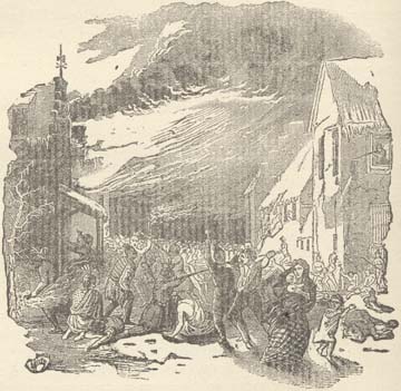
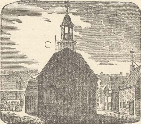
The vale on the right is Beukendaal or Beech vale. Along its sides occurred the skirmishing fight, exactly where, no one knows, or can know. The whites made a stand in the old red house and held their own against the Indians until relief arrived. (Heliotype.)
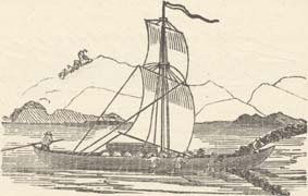
From Champlain's account. (Photo-engraving.)
Quite fully described on its face and in the text. (Photo-engraving.)
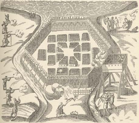
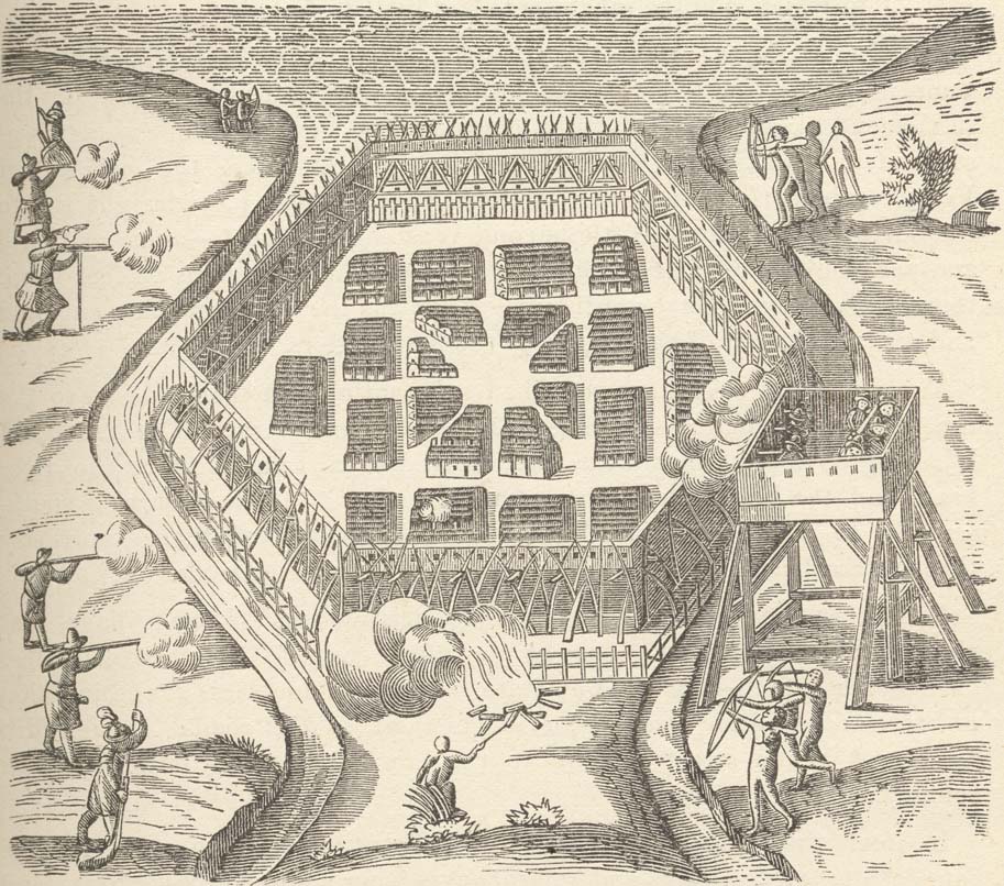
Copied from map in a curious little volume in the New York State Library, containing plans of royal forts in North America. This was doubtless engraved from a sketch by an officer of the British army stationed here or in the vicinity, and probably dates from the close of the "Old French War," or the beginning of the "2d French War," say from 1748 to 1763. (Photo-engraving.)
Is copied from a small rough manuscript map now in possession of Union College Library. (Photo-engraving.)
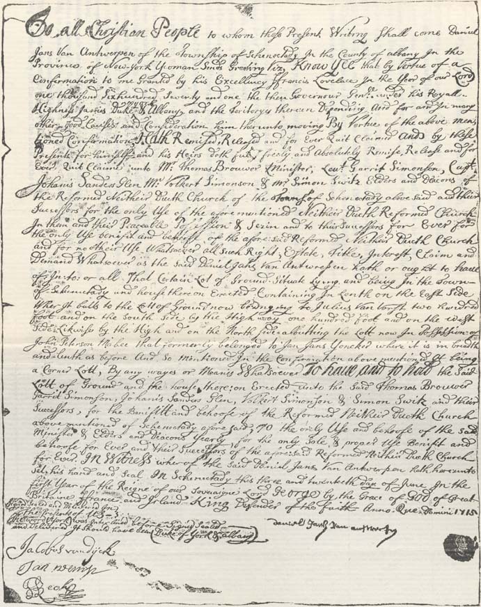
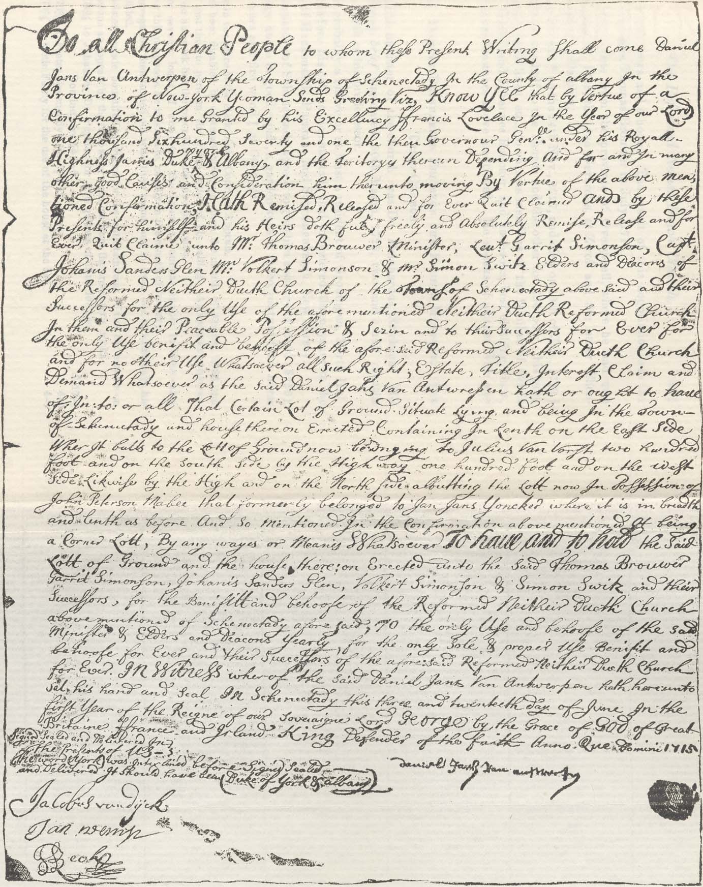
Copied from ancient document in the deacon's chest in the Dutch church at Schenectady. (Photo-engraving.)
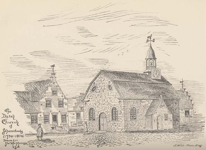
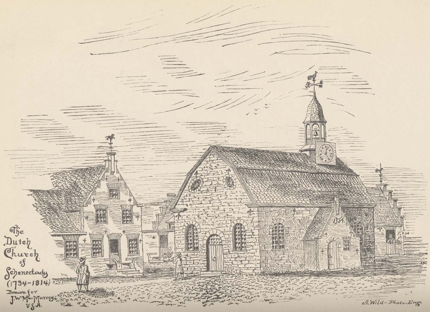
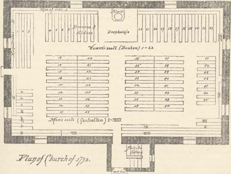
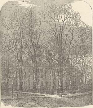
Constructed from descriptions, plans and the aid of elderly persons now living who were familiar with its appearance, from which a sketch was made by Mr. Franklin H. Janes, architect, of Albany, whose courtesy, skill and taste have been of much service to the editor. (Photo-engraving.)
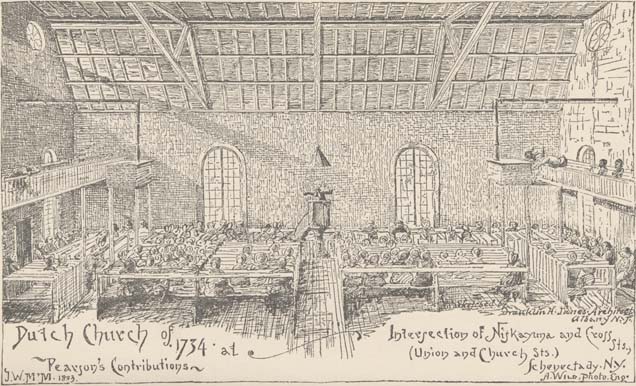
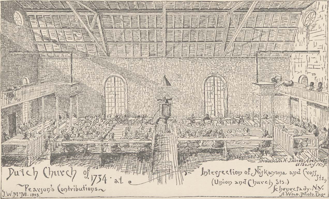
Was constructed in same manner as preceding cut. There are two errors in the drawing, the figures 1733, in Dutch style should have been on the wall over the pulpit, Genl. Fuller tells me, and the women in the congregation should have been bonnetless, as they rarely at that date wore bonnets or hats in or out doors. Probably also there are insufficient of the congregation asleep, but the sermon has not yet commenced as indicated by the sexton stirring up the fires. Photo-engraving from drawing of Mr. Franklin H. Janes, of Albany.
(Photo-engraving.)
From Giles F. Yates' painting. (Photo-engraving.)
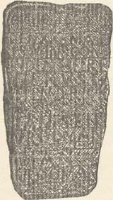
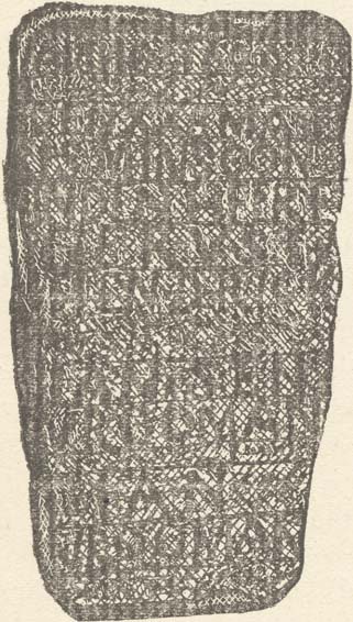
Copied from the stone in Union College Library. The inscription is dim and almost undecipherable. The cut is purposely made to show this, but the laid paper lifts made it worse. (Photo-engraving.)
(Cut.)
(Cut.)
By Guy Johnson, 1771, (Lithograph from a Steel engraving)
(Cut.) From Scribner's Magazine.
(Cut.) From Scribner's Magazine.
Go to top of page | back to: Table of Values | ahead to: Preface
You are here: Home » Resources » Pearson's History » Illustrations
http://www.schenectadyhistory.org/resources/patent/02.html updated March 30, 2015
Copyright 2015 Schenectady Digital History Archive — a service of the Schenectady County Public Library