This page conforms to the XHTML standard and uses style sheets. If your browser doesn't support these, you may not see the page as designed, but all the text is still accessible to you.

SCHENECTADY DIGITAL HISTORY ARCHIVE

Bringing the heritage of Schenectady County, New York to the world since 1996

You are here: Home » Resources » MVGW Home » Maps » New York State Ice Age

History of the Mohawk Valley: Gateway to the West 1614-1925
New York State During the last Ice Age

[This information is from Vol. I, p. 55 of History of the Mohawk Valley: Gateway to the West 1614-1925, edited by Nelson Greene (Chicago: The S. J. Clarke Publishing Company, 1925). It is in the Reference collection of the Schenectady County Public Library at R 974.7 G81h. This online edition includes lists of portraits, maps and illustrations. As noted by Paul Keesler in his article, "The Much Maligned Mr. Greene," some information in this book has been superseded by later research or was provided incorrectly by local sources.]

Contents | Biographies | Illustrations | Maps | Portraits

Go back to: Chapter 1

New York State During the last Ice Age.

[View 4x enlarged version (71K)]

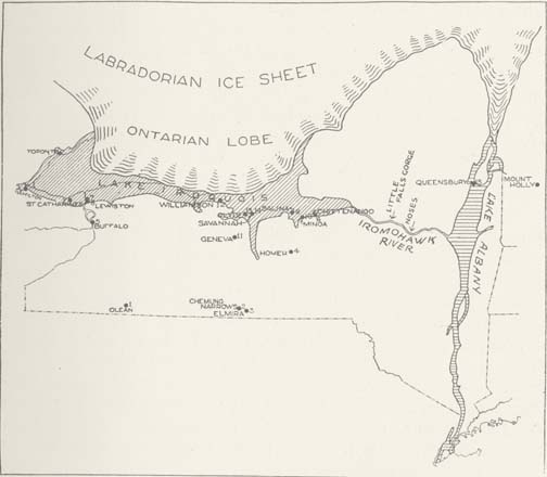
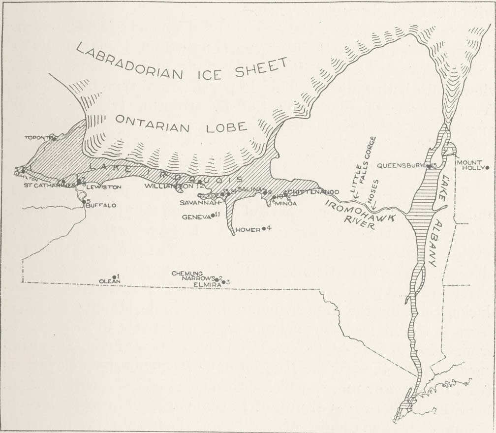
Map: New York State during the last Ice Age, depicting the Ontarian Lobe of the Labradorian Ice Sheet.

Map indicating preponderance of mammoth (not mastodon) remains in New York State, at the period of Lakes Iroquois and Albany. It was at this time of glacial recession, when the St. Lawrence Valley was still blocked by ice, that the great Iromohawk, carrying the waters of the Great Lakes basin through the channel of the Mohawk of today, cut down the Adirondack mountain barriers at present Little Falls and the Noses, moulded the lower levels of the Valley and made its channel bed where the fertile Mohawk flats now lie. The former annual spring freshets of the present Mohawk gradually laid a level bed of silt on this old Iromohawk channel, which makes the level flats of today. The Iromohawk River of this glacial period probably rivaled the present-day Niagara River. From New York State Museum Bulletin 241-242.

Go to top of page | back to: Chapter 1

You are here: Home » Resources » MVGW Home » Maps » New York State Ice Age

http://www.schenectadyhistory.org/resources/mvgw/maps/nys_ice_age_map.html updated June 10, 2018

Copyright 2018 Schenectady Digital History Archive — a service of the Schenectady County Public Library

Statcounter