[View 4x enlarged version (230K)]
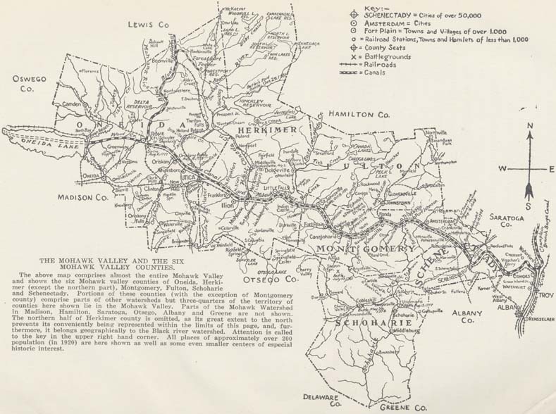
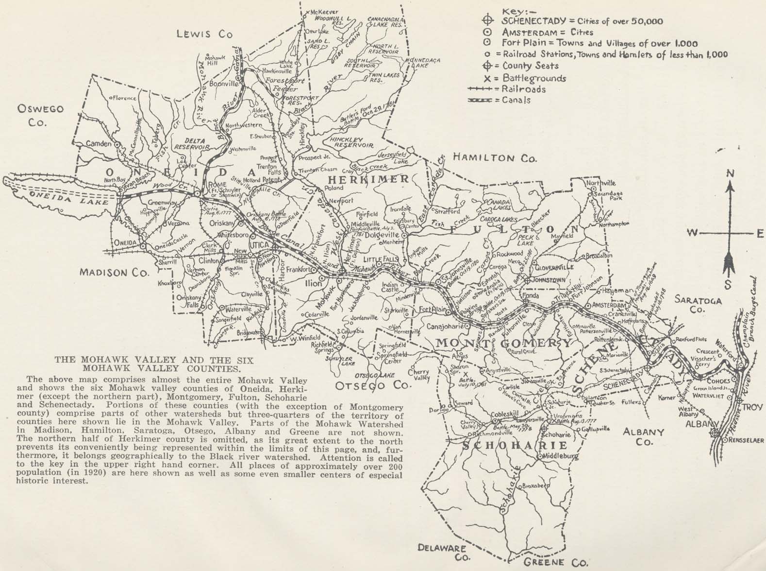
The above map comprises almost the entire Mohawk Valley and shows the six Mohawk Valley counties of Oneida, Herkimer (except the northern part), Montgomery, Fulton, Schoharie and Schenectady. Portions of these counties (with the exception of Montgomery county) comprise parts of other watersheds but three-quarters of the territory of counties here shown lie in the Mohawk Valley. Parts of the Mohawk Watershed in Madison, Hamilton, Saratoga, Otsego, Albany and Greene are not shown. The northern half of Herkimer county is omitted, as its great extent to the north prevents its conveniently being represented within the limits of this page, and, furthermore, it belongs geographically to the Black river watershed. Attention is called to the key in the upper right hand corner. All places of approximately over 200 population (in 1920) are here shown as well as some even smaller centers of especial historic interest.
Key:
- [symbol used for] Schenectady = Cities of over 50,000
- [symbol used for] Amsterdam = Cities
- [symbol used for] Fort Plain =Towns and Villages of over 1.000
- [symbol used for] Railroad Stations, Towns and Hamlets of less than 1,000
- [symbol used for] County Seats
- [symbol used for] Battlegrounds
- [symbol used for] Railroads
- [symbol used for] Canals