Series of maps illustrating drainage along the Mohawk River in various periods.
[View 9x enlarged version (35K)]
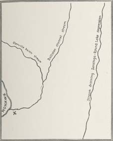
Fig. 1. Showing probable pre-glacial drainage of the lower Mohawk River outlet section. (X) marks present site of Schenectady. Labels include Glenville basin stream, Ballston channel stream and Stream draining Saratoga-Round Lake depression.
[View 9x enlarged version (61K)]
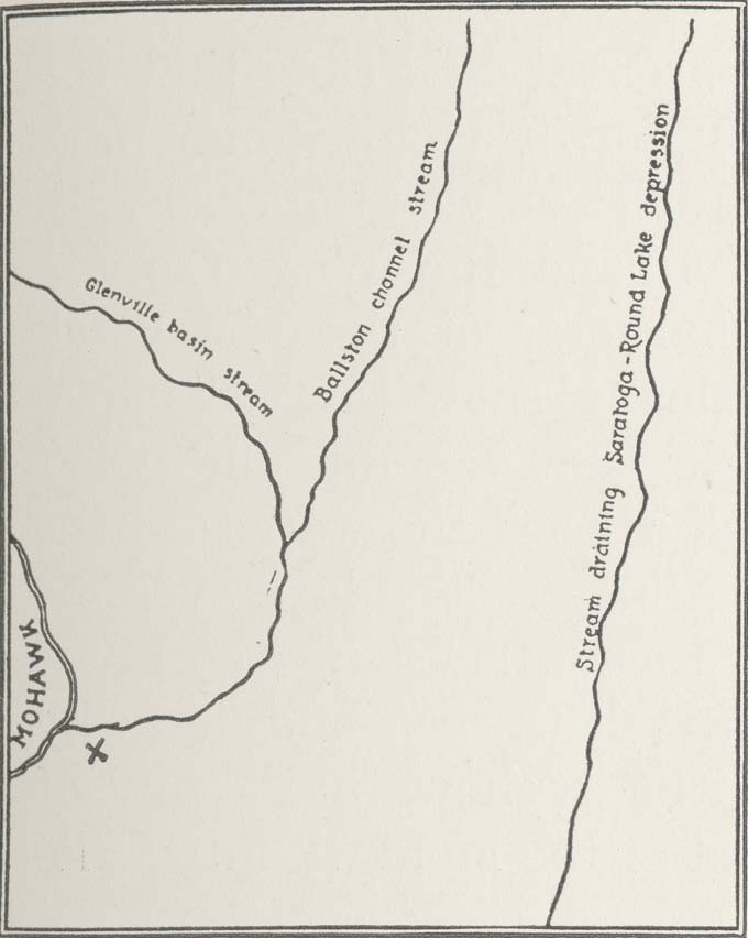
Fig. 2. Sketch map showing the distribution of land and water on the areas of the Schenectady and Cohoes quadrangles when Lake Albany was at the height of its development, its level corresponding to the present 360-foot contour. This was one of the early stages following recession of the glacier from the Mohawk Valley. Labels include Mohawk delta (Schenectady) and Hoosic delta (Schaghticoke).
[View 9x enlarged version (60K)]
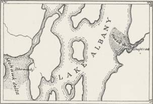
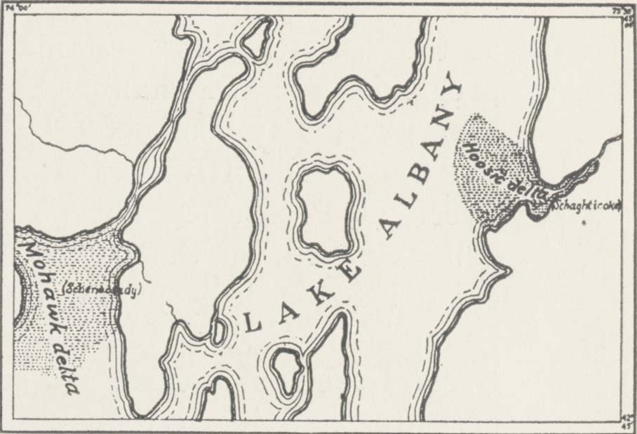
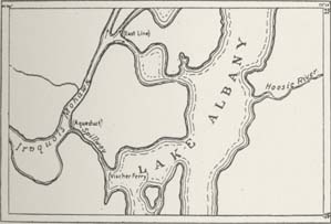
Fig. 3. Sketch map showing areal extent of Lake Albany and drainage courses on the areas of the Schenectady and Cohoes quadrangles at the time when the Lake Albany waters had subsided to the level represented by the present 320-foot contour. Labels include Iroquois Mohawk, East Line, Aqueduct, Vischer Ferry and Hoosic River.
[View 9x enlarged version (60K)]
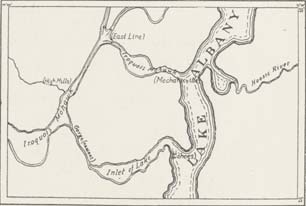
Fig. 4. Sketch map showing Lake Albany and drainage courses on the areas of the Schenectady and Cohoes quadrangles when the lake waters had subsided to the level represented by the present 240-foot contour. Labels include Iroquois Mohawk, High Mills, East Line, Gorge (nascent), Mechanicville and Hoosic River.
[View 9x enlarged version (52K)]
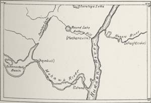
Fig. 5. Sketch map showing drainage of the areas of the Schenectady and Cohoes quadrangles and breadth of waters occupying valleys when Lake Albany had receded to the level represented by the present 100-foot contour line and had taken on the character of a broad river. The Mohawk River had lowered its gorge at Aqueduct to the 300-foot level. Labels include Schenectady Basin, Ballston Lake, Aqueduct, Round Lake, Anthony Kill, Mechanicville, Hudson River, Hoosic River and Schaghticoke.
[View 9x enlarged version (98K)]
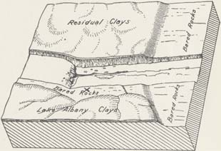
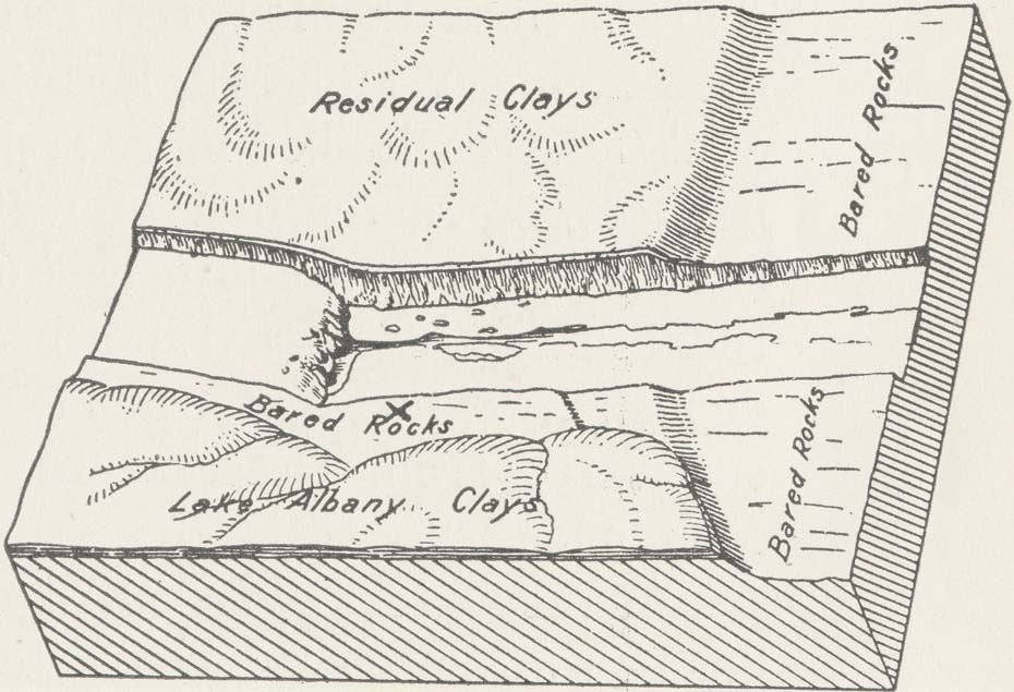
Fig. 6. Block diagram of the Cohoes region of the lower Mohawk. (X) marks site of Pothole where Cohoes Mastodon was found. Labels include Residual Clays, Bared Rocks and Lake Albany Clays.