This page conforms to the XHTML standard and uses style sheets. If your browser doesn't support these, you may not see the page as designed, but all the text is still accessible to you.

SCHENECTADY DIGITAL HISTORY ARCHIVE

Bringing the heritage of Schenectady County, New York to the world since 1996

You are here: Home » Resources » MVGW Home » Maps » Clinton's March

History of the Mohawk Valley: Gateway to the West 1614-1925
1779. Route of Clinton's March from the Mohawk River to Otsego Lake.

[This information is from Vol. I, p. 921 of History of the Mohawk Valley: Gateway to the West 1614-1925, edited by Nelson Greene (Chicago: The S. J. Clarke Publishing Company, 1925). It is in the Reference collection of the Schenectady County Public Library at R 974.7 G81h. This online edition includes lists of portraits, maps and illustrations. As noted by Paul Keesler in his article, "The Much Maligned Mr. Greene," some information in this book has been superseded by later research or was provided incorrectly by local sources.]

Contents | Biographies | Illustrations | Maps | Portraits

Go back to: Chapter 67

1779. Route of Clinton's March from the Mohawk River to Otsego Lake.

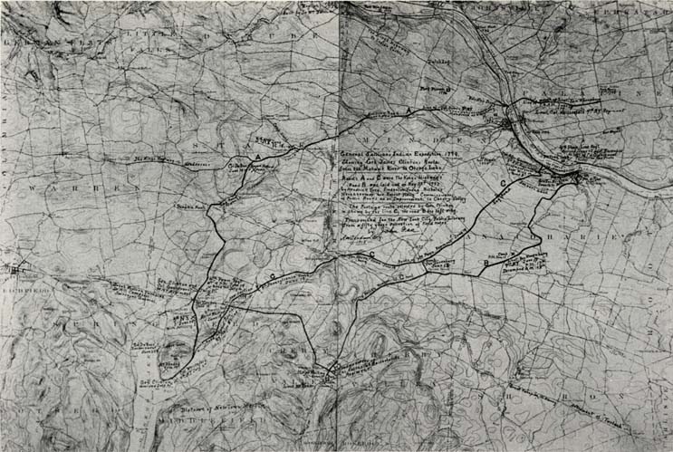
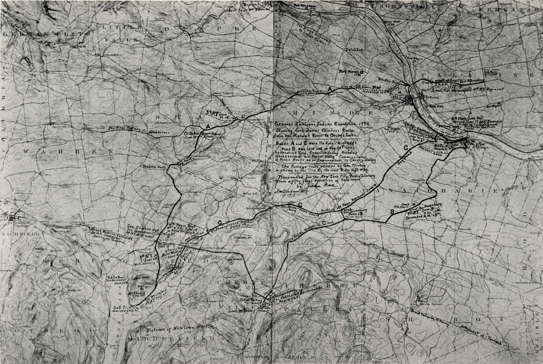
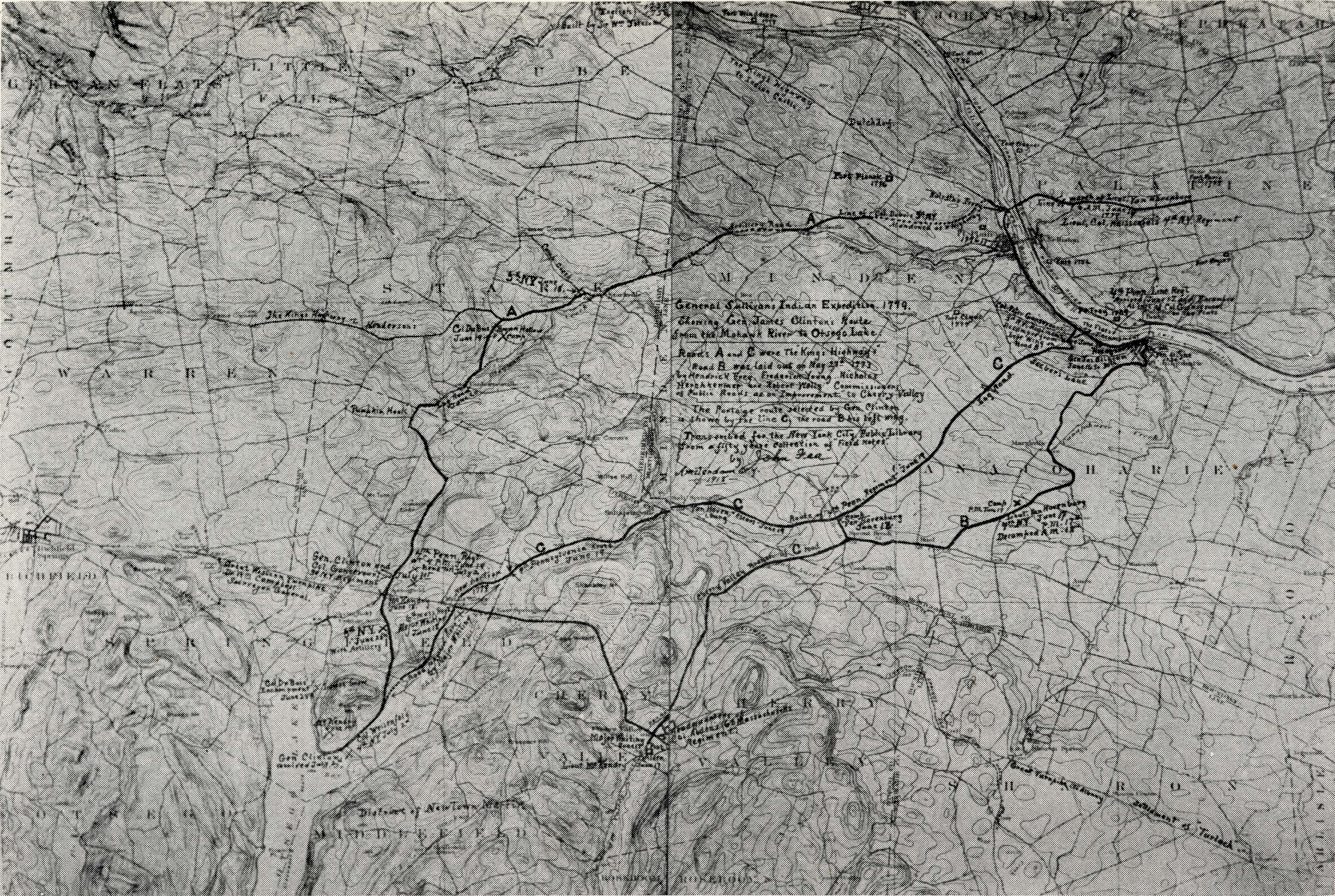
[View 9x enlarged (952K) and 36x enlarged (2248K) versions]

Map: 1779. Route of Clinton's March from the Mohawk River to Otsego Lake.

Notes by Mr. John Fea: As there was no official survey made by General Clinton of his route from the Mohawk River, the data here shown was gleaned from journals of his officers, which shows approximately the relative location of his regiments on certain dates. Location of forts shown by open squares. Forts Frey, Wagner and Klock are still existing. Improvement to the roads indicated where they were made by Clinton. At the crossing of Marshville Creek, many logs were used. Road marked "Pumpkin Hook" was made by Clinton's right wing, the 5th N. Y. Line. The log road mode, where Van Hornesville now stands, occupied the ground where the long row of buildings is, (including the home of Mr. Owen D. Young) close to the north hillside.

These are geological survey maps with the different points of interest of Clinton's march indicated thereon by Mr. Fea.

Go to top of page | back to: Chapter 67

You are here: Home » Resources » MVGW Home » Maps » Clinton's March

http://www.schenectadyhistory.org/resources/mvgw/maps/clintons_march_map.html updated June 10, 2018

Copyright 2018 Schenectady Digital History Archive — a service of the Schenectady County Public Library

Statcounter