This page conforms to the XHTML standard and uses style sheets. If your browser doesn't support these, you may not see the page as designed, but all the text is still accessible to you.

SCHENECTADY DIGITAL HISTORY ARCHIVE

Bringing the heritage of Schenectady County, New York to the world since 1996

You are here: Home » Resources » MVGW Home » Illustrations » Site of Fort Schuyler, 1758

History of the Mohawk Valley: Gateway to the West 1614-1925
Site of Fort Schuyler, 1758

[This information is from Vol. I, p. 608 of History of the Mohawk Valley: Gateway to the West 1614-1925, edited by Nelson Greene (Chicago: The S. J. Clarke Publishing Company, 1925). It is in the Reference collection of the Schenectady County Public Library at R 974.7 G81h. This online edition includes lists of portraits, maps and illustrations. As noted by Paul Keesler in his article, "The Much Maligned Mr. Greene," some information in this book has been superseded by later research or was provided incorrectly by local sources.]

Contents | Biographies | Illustrations | Maps | Portraits

Go back to: Chapter 47

Site of Fort Schuyler, 1758

[View 4x enlarged version (57K)]

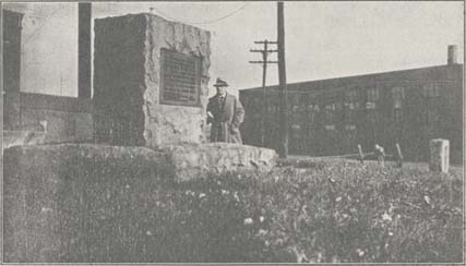
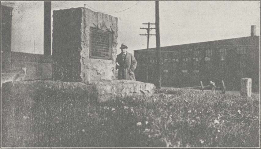
Photo: Site of Fort Schuyler, 1758

At the junction of Main street and Park avenue. The D. A. R. marker of 1912, at the right, commemorates the camp here of General Herkimer's American army on the night of August 6, 1777, following the battle of Oriskany.

Go to top of page | back to: Chapter 47

You are here: Home » Resources » MVGW Home » Illustrations » Site of Fort Schuyler, 1758

http://www.schenectadyhistory.org/resources/mvgw/images/fort_schuyler_monument.html updated June 10, 2018

Copyright 2018 Schenectady Digital History Archive — a service of the Schenectady County Public Library

Statcounter